ThingsEye Agricultural Irrigation Monitoring Solution End User Guide
Table of Contents:
1. Introduction
1.1 What is ThingsEye Agricultural IrrigationMonitoring Solution?
ThingsEye Agricultural Irrigation Monitoring Solution is an IoT-based system designed to help farmers optimize irrigation practices, conserve water resources, and improve crop yields. The system utilizes a network of wireless sensors to collect real-time data on soil moisture, temperature, humidity, and other environmental factors. This data is transmitted to a cloud-based platformfor analysis and visualization, providing farmers with actionable insights into their fields' conditions.
1.2 Features
- Easy Deployment
- Smart wireless sensors
- Plug-and-play gateway
- Scan-to-add device onboarding
- Real-time Monitoring
- 24 hours/ 7 day monitoring
- Moisture alarm
- High Precision Measurement
- High-accuracy sensors
- Reliable data readings
- User-Friendly Interface
- Intuitive dashboard design
- Customizable dashboard views
- Low Power Consumption
- Long battery life
1.3 Specifications
- Wireless Technology: LoRaWAN, NB-IOT, LTE-M
- Monitoring Parameters:Monitor soil moisture, temperature, humidity, and other parameters
- Long Battery Life: Operates for several years without maintenance
- Data Storage: 5 years of historical data
- Device Onboarding: Simple device registration for end-users
- Mobile Support: Dedicated mobile app for on-the-go monitoring
2. Dashboard Detail
2.1 Dashboard Interface Example
The dashboard provides an intuitive interface for real-time monitoring, data analysis, and control.


2.2 Detailed Features
Land-based alarm configurations
- When creating a land unit, select the crop type and set a soil moisture alarmthreshold.

- After creating the land, a “
 ” icon will appear on the right side, allowing you toset up an email address for alert notifications.
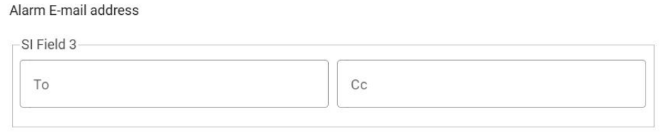
- irrigation scheduling
- Schedule irrigation events based on time or volume.
- Supports daily timed irrigation.

Multiple soil moisture measurements
The dashboard supports multiple soil moisture sensors on a single land unit.
- Automatically calculates the average soil moisture, considering different soil sizes and irrigation methods.

3. How to Build a Agricultural Irrigation MonitoringSolution
3.1 Network Structure
Agricultural Irrigation Monitoring system architecture

The network consists of terminal nodes, platform and gateway that work together to monitor environmental data in real time.
3.2 Get Account
Contact your local representative to register a customer account on ThingsEye.io.
3.3 Get Devices
Reach out to your local representative to acquire the necessary devices for your Agricultural Irrigation Monitoring Solution. These devices include:
- SE01: Soil Temperature, Moisture, Conductivity Measurement
- SPH01:Soil PH measurement
- SW3L:Water consumption monitoring
- WSC2:Meteorological monitoring (e.g., light intensity)
- LT22222:Irrigation switch
- Gateway: Data transmission.
Ensure that all devices are pre-registered on ThingsEye.io before use.
3.4 Connect the Gateway
- Connect the gateway to your router using an Ethernet cable.
- Power on the gateway and allow it to obtain an IP address from the router. Ensure the gateway has a stable internet connection.
3.5 Create Field And Create Device
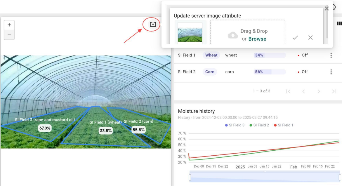
- Update Dashboard Image: Click the button in the upper right corner of the dashboard imagewidget to update the image.
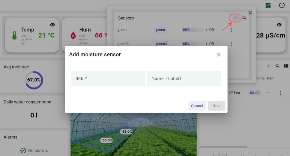
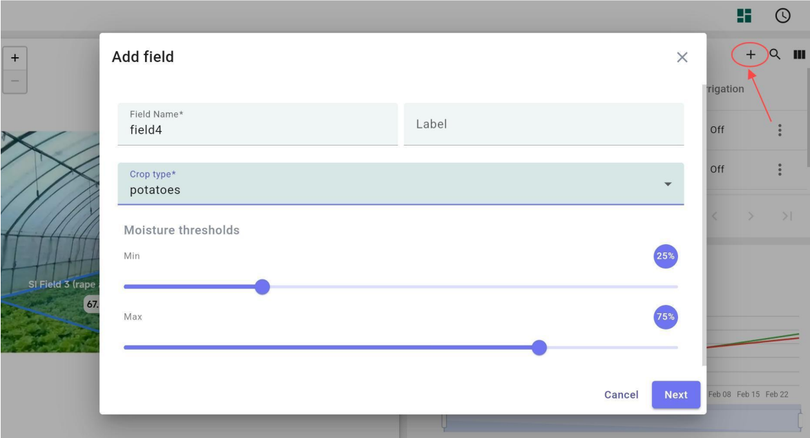
- Add a Field: Click the “+” in the upper right corner of the field list, enter the name, label, andother information, and set the humidity alarm threshold.
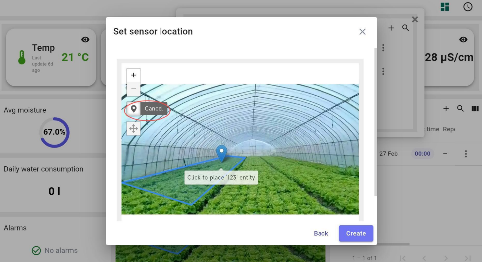
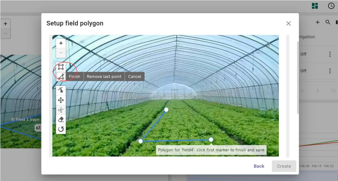
- Outline Land Area: Define the land area on the map.
- Add Devices: Click on the newly added field, go to the second level of the dashboard, andclick the “+” to add a device. Fill in the device information and place it in the correspondingposition on the map.